Melbourne Urban Planning: The Complete Guide to Sustainable City Design
Global city leaders and urban designers frequently look to Victoria’s capital as an international benchmark for metropolitan renewal and sustainable […]
Global city leaders and urban designers frequently look to Victoria’s capital as an international benchmark for metropolitan renewal and sustainable growth. Over the past four decades, Melbourne urban planning has orchestrated a remarkable transformation, converting a once-quiet central business district into one of the most vibrant, walkable, and resilient urban environments in the Southern Hemisphere. Known worldwide for its rich arts culture, iconic bluestone laneways, extensive tram network, and sprawling parklands, the city offers an inspirational blueprint for municipal governments seeking to balance rapid population growth with environmental stewardship and exceptional quality of life.
Understanding the mechanics of Melbourne urban planning requires analyzing how visionary design frameworks, community-driven governance, and transit-oriented development work in unison. Rather than allowing car-centric suburban sprawl to dictate growth, local authorities and state planners implemented proactive spatial strategies that emphasize high-density housing, public transit access, and human-scaled streetscapes. As municipalities across North America contend with housing shortages, climate vulnerability, and automobile dependence, the pioneering techniques forged in southeastern Australia present timeless principles for building liveable, future-proof communities.
The Historical Evolution of Melbourne Urban Planning
The foundation of the city’s spatial layout dates back to 1837, when surveyor Robert Hoddle laid out a formal grid along the northern bank of the Birrarung (Yarra River). Known as the Hoddle Grid, this initial spatial arrangement featured wide primary thoroughfares measuring 99 feet across, interspersed with narrow secondary lanes designed for rear service access. While the grid provided an orderly framework for nineteenth-century commerce and Victorian-era architecture, mid-twentieth-century industrial shifts and suburban automobile expansion gradually drained the inner city of its residential population, turning the core into a sterile commercial zone after business hours.
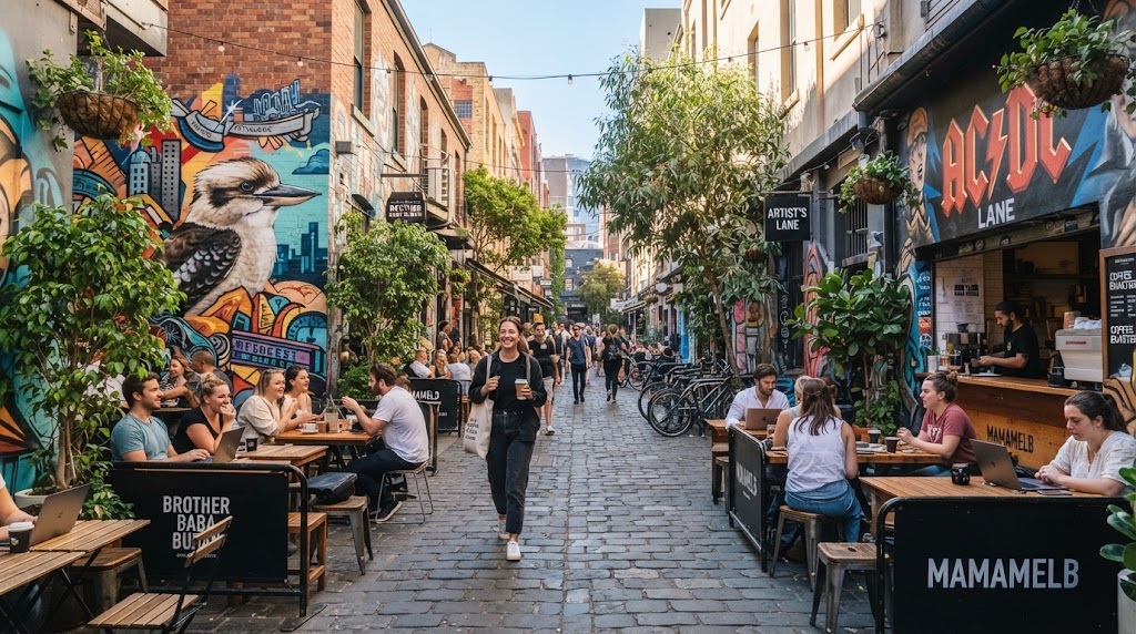
The true turning point for Melbourne urban planning occurred during the late 1980s and early 1990s through a series of transformative urban renewal policies. Led by urban design visionary Rob Adams and the City of Melbourne council, the revolutionary “Postcode 4000” initiative sought to reintroduce residential living into the central business district. By converting underutilized heritage buildings into apartments, widening footpaths, encouraging outdoor sidewalk dining, and transforming service alleys into vibrant pedestrian laneways filled with cafes and public art, planners successfully reactivated the street realm. This human-centered approach laid the groundwork for modern Melbourne urban planning, establishing street-level vitality as a non-negotiable metric of urban health.
Core Frameworks Driving Melbourne Urban Planning Strategies
At the heart of contemporary growth management is “Plan Melbourne 2017–2050,” a comprehensive metropolitan strategy crafted by the Victorian State Government to guide land use, housing, infrastructure, and transport across the greater region. As the city prepares to accommodate a projected population of over eight million residents by mid-century, this overarching blueprint establishes a polycentric network of urban hubs. Instead of relying solely on the central core for employment and services, the strategic model designates National Employment and Innovation Clusters (NEICs) and Metropolitan Activity Centres across the suburbs to distribute economic activity equitably.
A central objective embedded within Melbourne urban planning frameworks is managing the balance between inner-city infill development and greenfield expansion on the metropolitan fringe. By directing high-density residential projects toward transit corridors, commercial precincts, and former industrial sites—such as the Arden urban renewal precinct and Fishermans Bend—planners protect agricultural land and natural ecosystems surrounding the city. Furthermore, recent strategic updates reinforce Indigenous cultural heritage, ensuring that urban expansion respects First Nations connections to land and water while incorporating climate-resilient construction standards across all municipal precincts.
The 20-Minute Neighborhood Concept in Practice
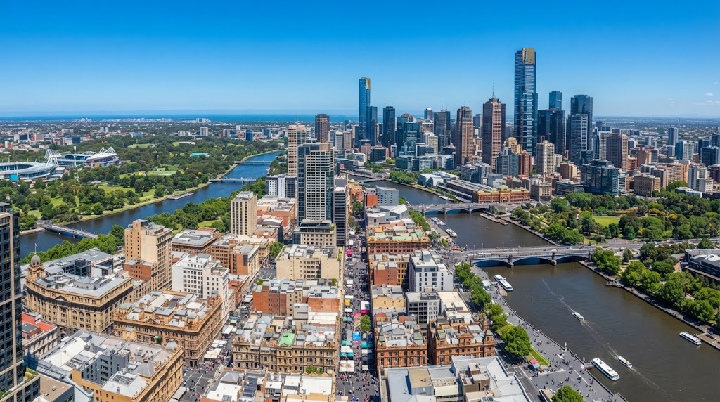
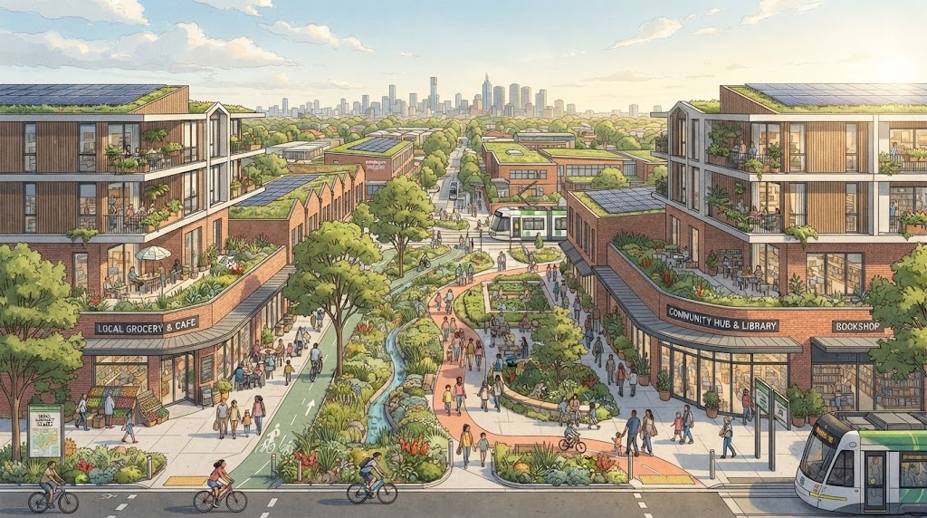
One of the most globally influential innovations produced by Melbourne urban planning is the practical application of the 20-minute neighborhood concept. Adapted from international proximity models like the 15-minute city, this planning policy is designed to give residents walkable access to most daily, non-work needs within a 20-minute round trip from home on foot, by bicycle, or via local public transport. In spatial terms, this translates to an 800-meter (half-mile) walkable catchment surrounding residential neighborhoods, equipped with essential community services, grocery stores, healthcare facilities, schools, and parks.
Implementing 20-minute neighborhoods through Melbourne urban planning requires establishing six foundational hallmarks of liveability: safe pedestrian and cycling networks, thriving local commercial economies, accessible public services, climate-resilient infrastructure, high-quality public open space, and viable residential density. By encouraging medium-density housing—such as townhomes, courtyard apartments, and dual-occupancy infill—in established suburbs, planners create the local population thresholds needed to support small businesses and frequent transit routes without sacrificing neighborhood character.
Transit-Oriented Development and Infrastructure Transformation
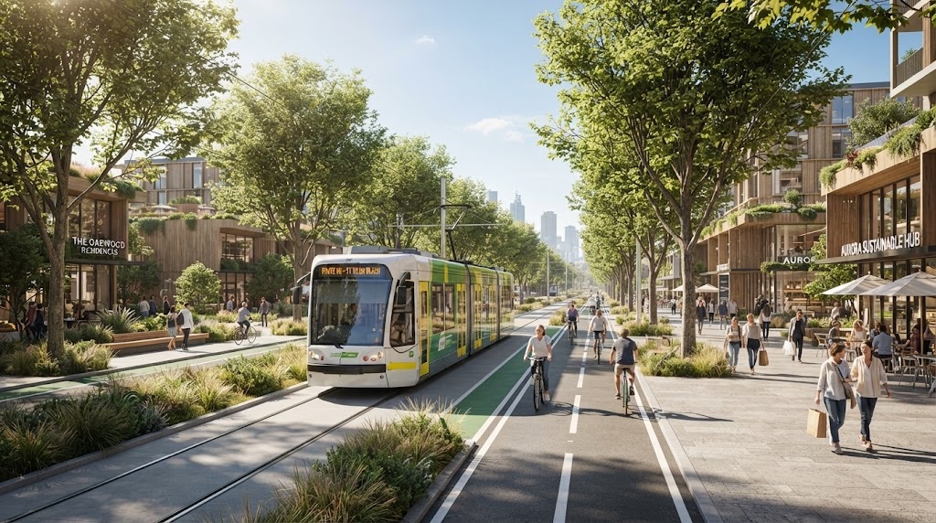
A successful walkable city relies heavily on robust, integrated public transportation networks. Historically blessed with the world’s largest operational streetcar network, Melbourne urban planning leverages rail and tram infrastructure to drive transit-oriented development (TOD). Rather than treating transportation projects purely as engineering exercises, major infrastructure investments are utilized as catalysts for neighborhood revitalization, commercial precinct creation, and high-quality public space design.
Current mega-projects illustrate how Melbourne urban planning weaves mass transit into urban design:
- The Metro Tunnel Project: A massive underground rail line featuring five high-capacity underground stations, directly linking high-density employment precincts like Arden and Parkville to the central core.
- The Suburban Rail Loop (SRL): An orbital rail network connecting middle-ring suburbs, enabling cross-suburban travel without requiring passengers to route through the central business district.
- Level Crossing Removal Program: An ongoing initiative removing dozens of dangerous railway level crossings, replacing them with elevated or underground rail corridors that unlock miles of linear parks, community gardens, and grade-separated cycling paths underneath.
By pairing station construction with mixed-use zoning, municipal planners ensure that new housing sits directly adjacent to high-frequency, turn-up-and-go public transit options.
Green Infrastructure, Biophilic Design, and Climate Resilience
Amid rising global temperatures and increased weather volatility, environmental resilience serves as a foundational pillar of modern Melbourne urban planning. The city’s Urban Forest Strategy represents a world-class model for combating the urban heat island effect. Municipal arborists and ecological planners have set ambitious targets to increase canopy cover across the municipal area, planting thousands of climate-adapted trees annually, diversifying species selection, and monitoring canopy health through digital mapping platforms.
Complementing urban forestry, Melbourne urban planning incorporates Water-Sensitive Urban Design (WSUD) and biophilic elements into everyday streetscapes. Permeable paving, bio-retention swales, rain gardens, and stormwater harvesting systems capture runoff to irrigate urban parks while protecting the ecological health of the Birrarung (Yarra River). Major civic initiatives, such as the Greenline Project, aim to transform former industrial riverfronts into interconnected parks, cultural walking trails, and restored wetland habitats. These green corridors mitigate flood risks, enhance urban biodiversity, and provide accessible recreational spaces for dense urban populations.
Lessons for American Cities and Future Urban Challenges
As municipalities across the United States seek solutions for automobile dependence, housing affordability, and urban decay, the strategies forged through Melbourne urban planning offer invaluable operational insights. American cities that developed around highway networks can adapt Victoria’s polycentric growth models, converting suburban strip malls and sprawling parking lots into walkable, transit-adjacent activity centers. Furthermore, adopting gentle density zoning—permitting accessory dwelling units, duplexes, and low-rise apartments within single-family zones—allows cities to expand housing supply organically while preserving neighborhood aesthetics.
However, the journey of Melbourne urban planning is not without ongoing challenges. Rapid population expansion continues to put pressure on housing affordability, while low-density car-dependent sprawl along the outer metropolitan fringe highlights the difficulty of delivering public transit and social services to expanding suburban borders. Balancing heritage preservation with the urgent need for new residential construction requires constant policy refinement. By maintaining transparent community engagement, investing in active transport networks, and committing to long-term spatial visioning, planners demonstrate that cities can adapt, grow, and flourish sustainably.
Frequently Asked Questions
What is the core goal of urban planning in Melbourne?
The primary goal of Melbourne urban planning is to guide sustainable growth, enhance liveability, manage population density, and ensure that all residents have access to high-quality housing, public transport, employment, green open spaces, and essential community services through integrated spatial strategies like Plan Melbourne 2017–2050.
How does the 20-minute neighborhood concept work in Melbourne?
The 20-minute neighborhood concept aims to give residents access to most of their daily non-work needs—such as grocery shopping, medical care, parks, schools, and transit stops—within a 20-minute round trip from home on foot, by bike, or via public transport. It relies on an 800-meter walkable radius and supportive local housing density.
Why is street-level design so important to Melbourne urban planning?
Street-level design prioritizes human interaction, safety, and vitality. By creating wide footpaths, active building facades, outdoor dining areas, and pedestrianized laneways, planners transform public streets into vibrant social spaces that support local businesses and encourage active walking and cycling.
What is the Hoddle Grid in Melbourne’s urban design history?
The Hoddle Grid is the original 1837 street layout created by surveyor Robert Hoddle along the Birrarung (Yarra River). Featuring wide primary streets and narrow service lanes, this grid forms the physical foundation of the current central business district and enabled the iconic laneway culture seen today.
How does Melbourne urban planning address climate change and heat islands?
Planners combat climate impacts through the Urban Forest Strategy, aiming for high tree canopy coverage, Water-Sensitive Urban Design (WSUD), rain gardens, bio-swales, and green infrastructure like the Greenline Project. These initiatives lower ambient urban temperatures, manage stormwater, and protect biodiversity.
What major public transit projects support Melbourne urban planning?
Key transit projects include the Metro Tunnel Project, the Suburban Rail Loop, and the Level Crossing Removal Program. These projects integrate high-capacity rail lines with urban renewal precincts, reducing automobile dependence and driving transit-oriented development.
How can American cities implement lessons from Melbourne urban planning?
American cities can adopt gentle density zoning, retrofit suburban car-oriented commercial corridors into walkable activity centers, invest in active transport infrastructure (bike lanes and pedestrian paths), and integrate long-term land-use planning with public transit expansion.
Conclusion
The enduring success of Victoria’s capital demonstrates that high-density urban growth and exceptional liveability can coexist harmoniously when guided by visionary spatial design. Through decades of dedicated policy execution, Melbourne urban planning has successfully transformed an industrial, car-centric city into a global model of walkability, transit integration, and biophilic resilience. From the activation of heritage laneways to the widespread implementation of 20-minute neighborhoods and massive rail infrastructure, the city provides a clear roadmap for modern urban renewal. As global cities face the twin challenges of climate change and rapid urbanization, the progressive strategies embedded within Melbourne urban planning will continue to inspire urban designers, policymakers, and communities worldwide to build safer, greener, and more connected human-centered cities.

Written by Twastia Editorial Team
Twastia Editorial Team shares practical insights about website design, SEO services, Google Ads, content marketing, social media, conversion rate optimization, and digital marketing strategy.
Last updated: Oct 19, 2026
Related posts from Twastia
Explore more useful articles from twastia.com about digital marketing, SEO, websites, ads, content, and growth strategy.